Dried Up: Precipitation and Groundwater in the Capital District
The July/August issue of Capital District Data is now available from the Capital District Regional Planning Commission. This issue explores the recent drought conditions in the Capital Region. We examine precipitation rates and groundwater depths and how these have impacted the Region’s agriculture.
Below average precipitation for the first half of 2016
Between January 1st and July 31st of 2016, the Capital Region experienced six months of below average precipitation with only February recording above average precipitation. By the end of February, the Region was running slightly above average in terms of precipitation. However, March and April saw precipitation totals account for 52.2% and 71.9% of their monthly averages — undoing any gains made in February. By the end of April, the Region had a year-to-date deficit of nearly 2 inches. The Summer brought continued dry weather with June in particular bringing only 75% of its typical rain. By the end of July, the deficit had grown to 3.8 inches.
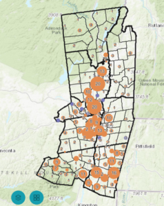
The Region’s drought is a result of more than below average precipitation in the Spring and Summer months. The Winter of 2015-16 was very mild, with Albany recording less than 33% of its average annual snow accumulation. This mild winter resulted in very little snow melt, leaving soil moisture low as Winter gave way to Spring. The lack of snow melt has compounded a running deficit in many of the Region’s aquifers that have left them in a deficit stretching back a year or two depending on the aquifer. Four of the Region’s six aquifers, including the two largest, now find themselves at, or near, historic lows.
NYS issues first State-wide drought notification in 14 years
The combination of below average precipitation and low snow melt resulted in the New York State Department of Environmental Conservation issuing its first State-wide drought notification in 14 years. These dry conditions have had a sizable impact on agricultural locally, as experts warn that field crops will be hardest hit by the dry weather. Low quantity and/or low quality harvests of hay and especially corn are anticipated. These are staple crops for many farms. A poor harvest combined with low milk prices could result in a financially difficult time for some of the Region’s farms. Soybeans, on the other hand, may still have a healthy harvest. This is due to August rains that arrived too late for corn and hay.
Average fall/winter precipitation can reverse the drought
Long term deficits, especially those of the Region’s aquifers, are concerning. However, experts agree that average Fall precipitation and average Winter snowfall would be enough to reverse the drought. The primary worry would be a mild winter of 2016-17 that delivers well below average snowfall. If such an event were to occur it would leave the Region is a precarious position next Spring. The Region’s aquifers are in need of significant recharge as they have been heavily drawn down. Slow snow melt is very effective in recharging aquifers than precipitation. Without it, aquifers could remain at or near historic lows. This, in turn, could lead to challenging conditions as the Region’s farms may struggle to irrigate their fields.