Regional Development maps show trends in development throughout the region and how land has been utilized over time. Maps include population change, population density, residential development, and more. These maps are updated to show current and available information.
Net Population Change 1960-2010 Population Change 1960-2010
Net Population Change 2010-2018 Percent Population Change 2010-2018
Projected Net Population Change 2010-2050 Population Density
Land Cover Residential Development 1945-2018
Urban GrowthResidential Development 2008-2018
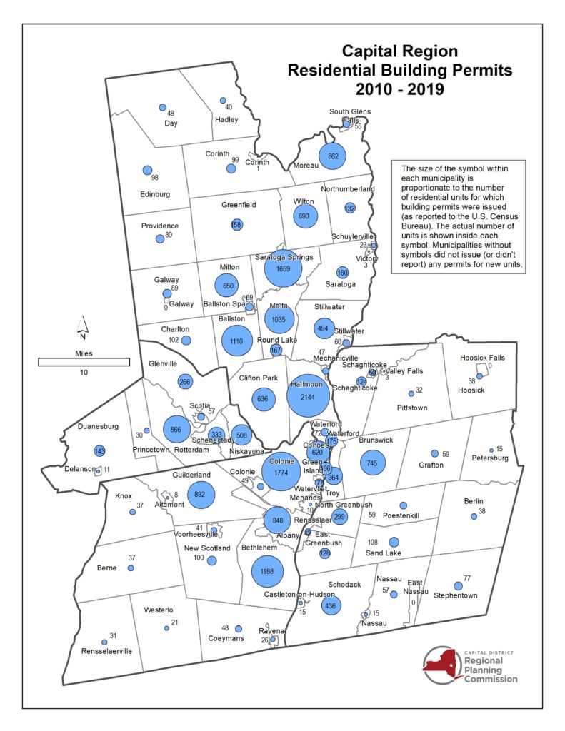
Building Permits 1999-2019 Building Permits 2010-2019