2020 Census
Percent and Net Population Change by Municipality 2010-2020
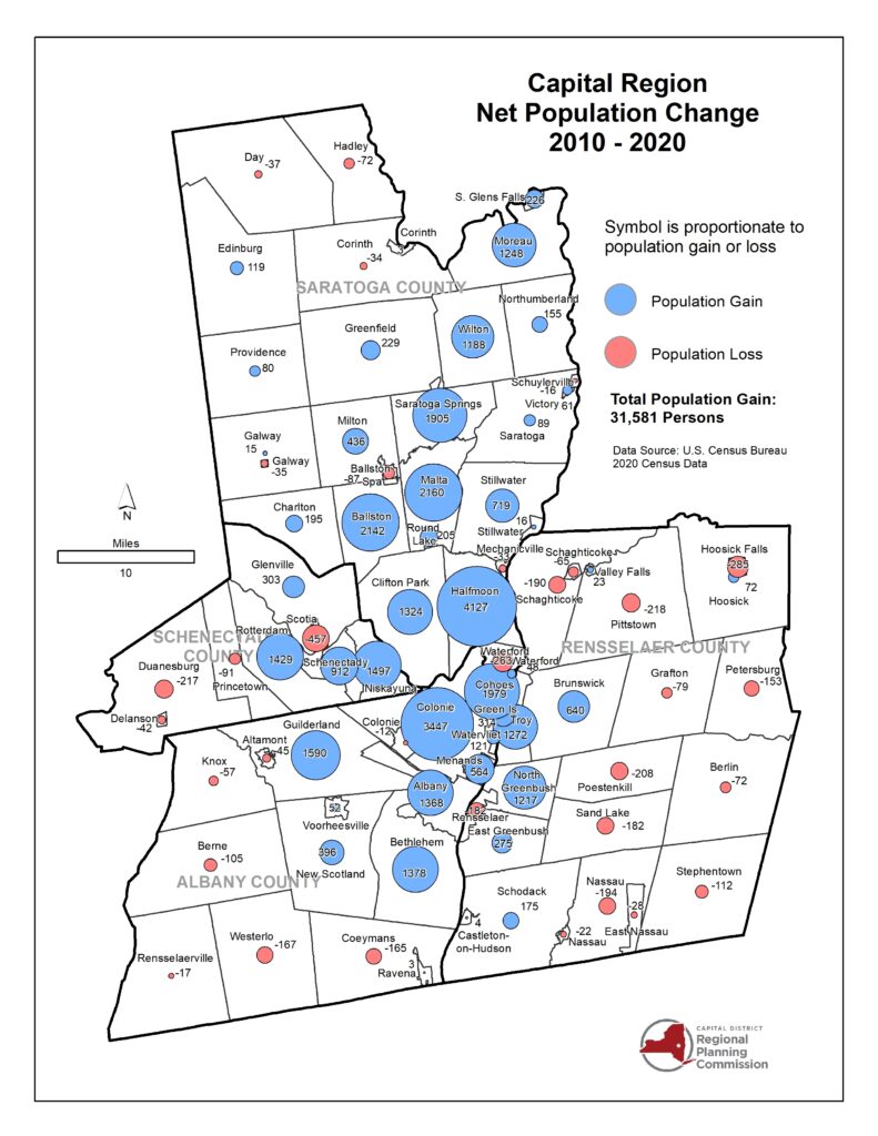
CDRPC has created two maps displaying the population changes within the capital region from 2010-2020. The net population change map shows the top areas for largest growth are:
- Halfmoon (+4,127)
- Colonie (+3,447)
- Malta (+2,160)
- Ballston (+2,142)
- Guilderland (+1,590)
The areas with the greatest population loss are:
- Scotia (-457)
- Hoosick Falls (-285)
- Pittstown (-218)
- Duanesburg (-217)
- Poestenkill (-208)
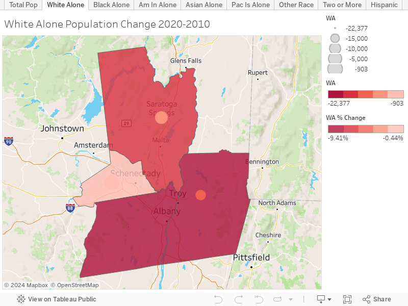
The percent population map displays the regions with the increased or decreased population changes. Overall, Saratoga county has the most municipalities with a positive percent growth between 15.01% and 32.91%, which include Halfmoon, Ballston, and Malta. Rensselaer county has the most municipalities with a negative percent growth between -17.5% and 0% which include Schaghticoke, Pittstown, Petersburg, Grafton, Berlin, Poestenkill, Sand Lake, Stephentown, Nassau, Waterford, and Rensselaer.
Population Change by County 2010-2020
This map features population change by County across the Capital Region. You can switch between data topics by selecting the tabs at the top of the visualization.
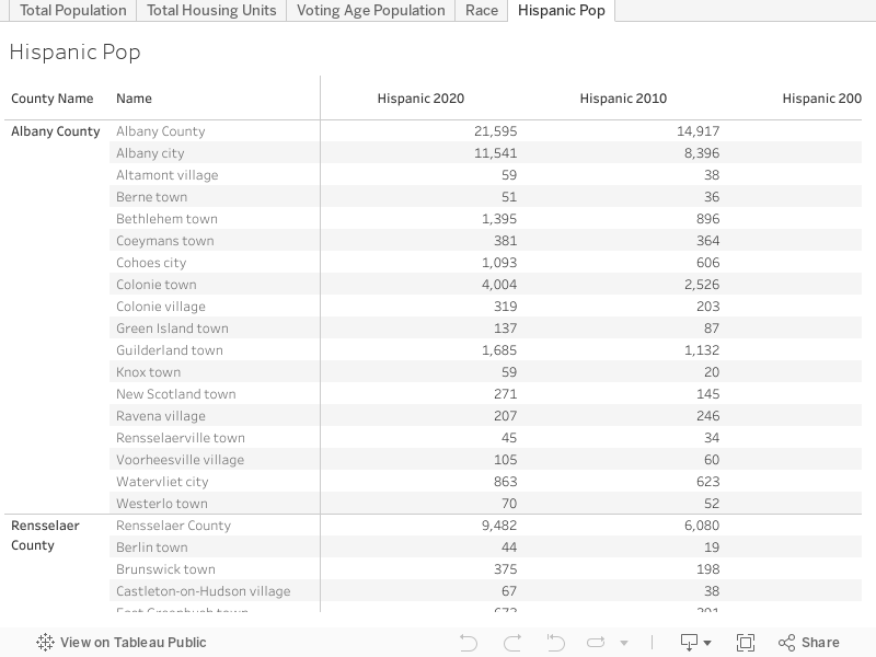
Total Population and Housing Counts 2000-2020
This workbook shows the total population counts for 2020, 2010, and 2000, as well as total counts for housing units, population by race, voting age population, and the Hispanic population for the region.
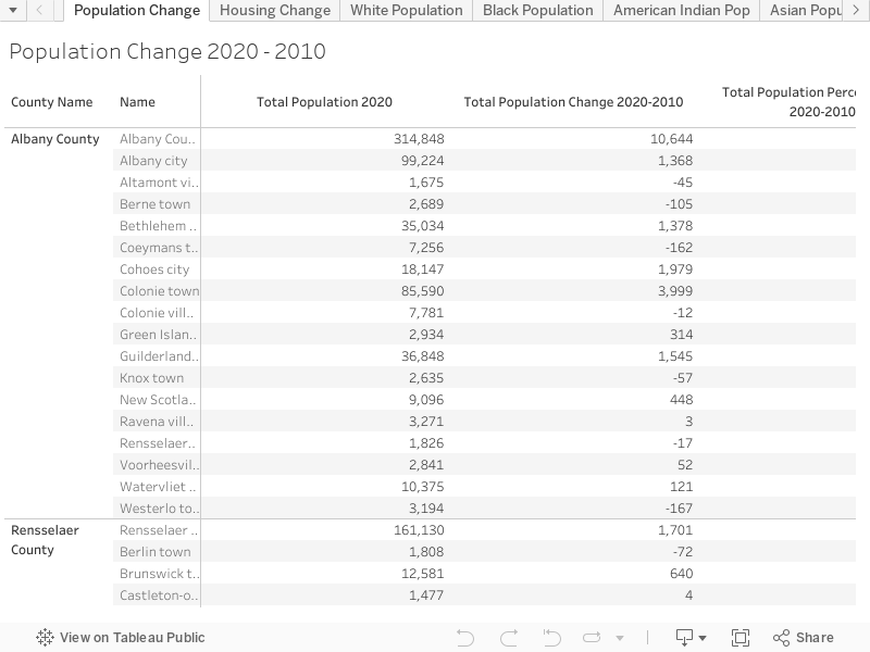
Population and Housing Changes 2020-2010
This workbook contains the 2020 counts, the overall change from 2010 and the percent change from 2010. This data is available for the overall population count as well as housing units and population by race.
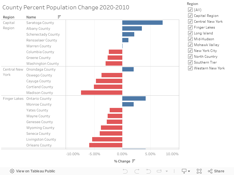
Statewide County Percent Population Change 2020-2010
For data at the County level, check out our workbook providing a look at population change for each county in New York State broken down by region.
Other Resources
Cornell Program on Applied Demographics 2020 Census Results