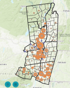
Capital Region Solar Array Inventory
The Capital Region Solar Array Inventory, developed by the Capital District Regional Planning Commission (CDRPC), is an interactive mapping tool that provides a regional view of existing solar energy installations across the Capital Region. The inventory was created using Esri’s Solar Photovoltaic Park Classification Model and June 2026 Copernicus orthoimagery to identify both new solar arrays and smaller facilities under 1 megawatt (MW) that may not yet be included in the U.S. Photovoltaic Database (USPVDB). By complementing existing national datasets, the inventory helps municipalities, planners, researchers, and residents better understand the region’s growing renewable energy landscape and supports informed planning and sustainability initiatives.
CDRPC Solar Array Inventory boundaries may appear empty when exploring the map. This is because the underlying imagery in the mapper may be older than the imagery used to create the Solar Array Inventory layer, which was as recent as June 2026.
Explore the interactive map below: